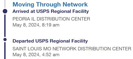
The CPAP mask I ordered last Friday has finally made it back to Peoria from St. Louis. I wonder where it will end up today?
MjL 09 May 2024, 2:51 a.m.
Another fun #Scouting trip was to the Red Covered Bridge Trail near Princeton. The hike is eighteen-miles-long (according to Jeff’s journal) and took most of the day. I think I walked it at least twice.
There are two stories I believe are related to this hike. I don’t think they happened on the same trip.
On one of the trips, it was very chilly, and spirits began to wane. The leaders handed out Tootsie Rolls for an energy boost (with strict instructions to put the wrappers in our pockets). Mr. Wood told a story about the Marines in the Korean War eating them. I had always thought it was just another Mr. Wood story, but just recently I happened upon an Internet page about it.
The other was a panic caused by gunfire. We heard gunfire quite near, and the leaders started shouting, “Get down! Lay on the ground!” and then yelling “Stop Shooting!” in the direction of the shooters. Mr. Mitchell continued to yell as he headed that way and the shooting stopped. I didn’t see the shooters but heard plenty of expletive laden anger from Mr. Mitchell about shooting in a prohibited area.
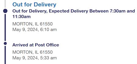
Another USPS update - looks as if it might get here yet today. From Peoria to Morton and it only took six days!
MjL 09 May 2024, 7:03 a.m.
Michael,
Thanks to you, I now remember the Tootsie Rolls pass out, and also picking up someone’s discarded wrapper!
Here’s the map I have of the Red Covered Bridge Trail. About two-thirds of the way along, the trail left Bureau Creek to follow Masters Fork. As best I can determine, the campsite was along Bureau County Road 2300N. My father must have helped drop us off or pick us up on one trip. I found a note he wrote with directions to get to the campsite - they’re about as clear as the trail map with its unlabeled-roads. Apparently, the campsite was a 75-mile drive (one way) from Marquette Heights.

 About